Ordnance Survey
How data sharing and collaboration can solve great challenges
Daniel Hirst and Arjan Dhaliwal from Ordnance Survey argue for the value of data sharing, collaboration and data skills enhancement to address social, ecological economic problems
Co-operating to solve problems is instinctual and an essential driver of innovation. We all know the adage of two heads being better than one, and its scalable implication. In the field of data science, collaboration has created a thriving open source community that is built on data sharing and the exchange of expertise, and has even led to ground-breaking advancements in the field itself.
Today, data is one of the most valuable resources for enabling innovation across both the public and private sectors, and it is rarely the case that there isn’t some exchange required between the two to deliver compelling and useful applications, whether for commercial gain or societal good. However, there are barriers preventing effective data exchange and collaboration, which stymie innovation. But it doesn’t have to be that way.
The most logical reason for collaborating is simply to save time. Data that has been curated by one organisation might just as easily be collated and transformed into a usable dataset by another, as long as it has the technical expertise to do so, but this process will take significant investments of time and money. If the problem involves geospatial data, for example, it is often the case that the work has been done before.
Geospatial data has been around for a long time and there is a vibrant community of developers and data scientists working in this field across industries in both the public and private sectors, but there sometimes can be problems when it comes to accessing this data.
On the public sector side, the data can sometimes be siloed, and when it comes to private sector organisations that have commercialised the data with an application or packaged solution, there is a reluctance to share this data for free. The growth of open platforms and data services, from which geospatial data can be accessed and, where appropriate, sold, is one way this problem is being resolved.
There is also increasing recognition from governments across the world that geospatial data is essential for unlocking economic and social value, which has led to data-sharing incentives. The UK government’s Geospatial Commission, for example, defined its approach to unlocking the power of geospatial data with its Geospatial Strategy, which sets out these four missions:
- Promote and safeguard the use of location data.
- Improve access to better location data.
- Enhance capabilities, skills and awareness.
- Enable innovation.
The first mission even sets out explicitly that the Geospatial Commission will aim to identify “the high-value opportunities and corresponding barriers and incentives to enable more private sector data to be shared to drive economic growth and improve services to citizens and consumers”.
The Geospatial Commission’s most recent commitment to assess the UK’s geospatial data in line with FAIR (findable, accessible, interoperable and reusable) principles is also a key development in unlocking the power and potential of innovation in this area.
The data skills gap
Siloed data slows down innovation. It is a never-ending battle for data scientists and developers and leads to much frustration and soul-searching about what might have been achieved if only we had access to the right datasets. Fostering a more collaborative landscape and incentivising organisations to share their data is helping to turn the tide, but there is also a data skills challenge that must be overcome.
Local councils, for example, are charged with improving their communities, but there is significant competition when it comes to the allocation of resources. In short, councils are unlikely to have built out the data analytics capabilities required to uncover actionable insights. In the future, councils might have more robust data science capabilities (or any at all), but today the process of uncovering these insights is typically outsourced to third-party data specialists. In short, the data is available; it just needs to be surfaced and used in the right way.
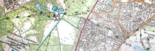
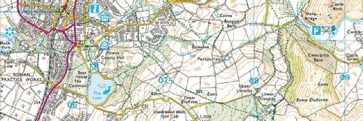
The importance of geospatial data
Where we live is one of the most important factors in our lives, so analysing the space available to people, as well as the quality of that space, such as how green, safe or prosperous it might be, is essential. Again, geospatial data is vital to establishing the inter-relationships between these factors. Take the example of the English indices of deprivation, which produce the Index of Multiple Deprivation (IMD) across England, including income, employment, education, health, crime, barriers to housing and services, and living environment.
At a high level, geospatial data defines the parameters of each location analysed, but it can also be used to provide a more detailed view of the factors leading to deprivation, as well as solutions that might improve the situation.
Read more about Ordnance Survey and data science
- Ordnance Survey: Insurance industry can harness big data analytics.
- Louise Weale from Ordnance Survey argues that geospatial data is key to unlocking business innovation in the property sector.
- CIO interview: Miranda Sharp, director of innovation, Ordnance Survey.
The IMD does not provide data on transport infrastructure, nor does it seek to discover how transport infrastructure might contribute to, or alleviate, levels of deprivation. It simply presents the material challenges that exist in a defined location, such as a local council. This is where data science can fill in the gaps and deliver truly life-changing solutions for citizens across the country.
When it comes to income deprivation, it stands to reason that enabling easier access and transit to areas where employment rates are higher might improve the situation of the deprived community, which is key factor behind the government’s national levelling-up agenda. Through deeper analysis of this contextual consideration across the country, we can determine whether improved transport infrastructure might be a significant factor in reducing deprivation and therefore make the case for targeted investment in this infrastructure.
This is how geospatial data can be used to analyse the relationships between locations and deliver value for society.
Everything in context
Geospatial data connects everything and is one of the most prolific data sources in the world. It’s also one of the most readily usable types of data, because it does not suffer from the same restrictions around usage and privacy that many other datasets are subject to. The European Space Agency’s Sentinel-2 constellation, for example, currently provides a high-resolution image of every spot on the planet at five-day intervals, which can be harnessed by data scientists and developers for free.
In the wake of COP26, there is an increasing interest in how remote sensing data, satellite imagery and geospatial data will allow us to track climate change, and its effects, in near-real time. Whether it is melting ice caps, coastal erosion, flooding or droughts, all of these changes are being analysed and assessed by data science teams around the globe, fostering further co-operation and data exchange between nations. But the question remains: what might we have achieved if we had only had this data earlier?
Daniel Hirst and Arjan Dhaliwal are data scientists in the rapid prototyping team at Ordnance Survey