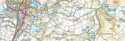
Ordnance Survey
CIO interview: Miranda Sharp, director of innovation, Ordnance Survey
Ordnance Survey’s innovation director talks about how the mapping agency is embracing new technologies, working on infrastructure for connected cars, and creating a geospatial framework in Manchester

UK mapping agency Ordnance Survey is moving forward with an innovation strategy to support projects including the development of the market for connected and autonomous vehicles and extending the organisation’s knowhow to international markets.
Despite being founded at the end of the 18th century, Ordnance Survey was the first national mapping agency in the world to digitise its content. The organisation provides accurate and interoperable data, which ensures that, for instance, emergency services get to the right place.
The data also supports town planning decisions and helps utility companies and insurance companies to understand the value and whereabouts of their assets.
Director of innovation Miranda Sharp is tasked with describing the future role of Ordnance Survey and how new technologies can contribute to its delivery. Her work touches everything from air quality sensors to 5G masts as government bodies, companies and individuals require a much more granular understanding of the location of items to support decision-making.
“In this world of connected objects and vast amounts of petabytes of data, everybody needs to know where things are,” Sharp tells Computer Weekly. “So I work with a whole range of partners and government departments advising on the data infrastructure around collaborative research and development [R&D] to make the world a smarter place.
“We also have an international ambition: if we can produce the best [in mapping data] for Britain, that will ensure the efficient delivery of public services and grow export capability. We are looking at taking that knowhow overseas, so that other countries can benefit from it as well.”
A key project for Sharp’s team in the months ahead is being carried out in partnership with the Centre for Connected and Autonomous Vehicles (CCAV), a UK government body focused on supporting the market for connected and automated vehicles.
.jpg)
“In the innovation space, you’re working with clever and innovative people who are constantly excited by new technology and new possibilities”
Miranda Sharp, Ordnance Survey
“We are working with some companies, but there are also academic layers and so much collaboration and policy-level ideas – all so that we can be at the forefront and write the standards, so that when it becomes a commercial proposition, we would have made sure that we’re at the front of that queue,” says Sharp.
Key to the work around driverless vehicles currently being carried out at CCAV is the development of systems geared at improving how people get around, safety being one crucial focus.
“For example, if there’s a sinkhole or if an emergency started, then it wouldn’t just be the Google cars or the Volvo cars that are able to avoid that incident – all cars would be able to avoid it to stop anybody else getting in danger, with traffic lights diverting everybody away from that incident,” says Sharp.
Smart city initiatives
Ordnance Survey is involved in various other R&D collaborations. These typically involve public sector bodies as well as other large private sector organisations such as BT, Cisco and Siemens.
One such initiative involves designing new services for the city of Manchester, with data and the internet of things (IoT) at its core. Here, Ordnance Survey is working with various local stakeholders – including the council, the university, the hospital as well as the tech companies – to provide a geospatial framework that informs the location data of about 40,000 objects.
“We needed to get the detail of those objects and know where everything was, so partners could apply the technology in different ways, with sensors, beacons, signage,” says Sharp. “That was a bit of R&D that we were interested in doing, but it was also helpful and pivotal for our partners.
“What was really interesting was that people were most impressed and most excited by the visualisation, standing in front of a giant video screen and seeing how the population moved around, how people used certain infrastructure, they really began to get excited and imagine how their lives might be transformed. ”
This, says Sharp, can enable a whole range of services including, for instance, making buildings accessible to people with various mobility needs, and analysing air quality. The project comes to an end next month and Ordnance Survey is now working with the Manchester authorities around the legacy programme.
Setting the innovation agenda
One of the challenges of Sharp’s job is defining what the innovation agenda will be in terms of commercial priorities, and the partners that Ordnance Survey will work with.
“In the innovation space, you’re working with clever and innovative people who are constantly excited by new technology and new possibilities,” she says. “Often, the challenge is focusing and concentrating on setting tangible outputs.
“So we focus on collaborative conversations and we are working at the policy level with people like the National Infrastructure Commission and various other stakeholders to see where the industry requires government intervention or investment in order to make the UK competitive, where the industry need to collaborate so that they can then compete in a proper way, and so on.”
In an environment of constant innovation, how does Sharp handle the issue of having to deal with moving goalposts in technology? The answer is tp try to strike a balance, says the executive.
“There are some problems that we need to solve, and I understand the technology and the new approaches I need to take in order to solve that problem,” says Sharp. “And at the other end of the spectrum, there’s some really cool tech.”
Read more CIO interviews
- PayPoint CIO Jon Marchant describes the company’s shift to retail services and how it went from knowing very little about electronic point of sale system software to creating its own.
- Estonia’s former CIO talks to Computer Weekly about how to make services work for people, why the skills gap shouldn’t be an excuse not to digitise, and the importance of going to the gym.
- Richard Tallboy, CIO of pan-Asian restaurant chain Wagamama, explains why the firm adopted “pay by walking out” technology.
Ordnance Survey has established academic partners and sponsors research for 15 universities, says Sharp. These academic partners then inform the organisation on what is coming up, what is exploitable and what can really make a difference.
Ordnance Survey also belongs to a number of all-party parliamentary groups in the UK, as well as international organisations such as the Open Geospatial Consortium, of which it is the only non-North American strategic member. Sharp says this is important in terms of keeping track of trends and ensuring the innovation agenda remains in touch with industry requirements.
As an innovation leader, she finds that constantly keeping her ear to the ground can be tricky at times, but enjoying the work makes it all manageable.
“I can spend every day with people who have brilliant ideas,” says Sharp. “The challenge is to be intellectual and to be sensible, even though people find it easy to burn themselves out.
“It’s about asking the right questions and quickly getting the answers. That way, you can sort the wheat from the chaff relatively quickly.”