After a joint call for proposals in July 2024 to be part of the European Space Agency’s (ESA’s) InCubed2 programme, the UK Space Agency has announced funding worth £2.5m for five projects across the UK to use satellite data to help transform the delivery of public services.
Space is identified as a frontier industry in the UK government’s new industrial strategy, a 10-year plan designed to increase business investment and grow the industries of the future in the UK. The new projects will see innovative space companies partner with public sector organisations ranging from local councils to government agencies. They will use a wealth of data from existing satellite networks to help monitor the safety of buildings and infrastructure, track animal and plant life, identify methane leaks and ensure farmers can access the right government support schemes.
“By bringing together innovative space companies with public sector partners, we’re demonstrating that space technology delivers practical benefits here on Earth. From monitoring biodiversity to ensuring infrastructure safety, these initiatives show how satellite data can drive efficiency, sustainability and better decision-making,” said Harshbir Sangha, director of missions and capabilities at the UK Space Agency.
“This investment reflects our commitment to establishing the UK as a global leader in space-enabled public services, creating a blueprint for how space technology can address some of our most pressing societal challenges.”
One of the projects will see Geospatial Ventures develop a system that tracks tiny movements in buildings, bridges and other structures to spot potential safety issues early. The system uses radar and artificial intelligence to constantly monitor infrastructure that might be difficult or expensive to check manually, providing a safer, more efficient way to survey large sites without sending engineers to dangerous locations.
AAC Clyde Space is creating a tool to help farmers support wildlife on their land, make better decisions about sustainable farming and access government support schemes such as the Sustainable Farming Incentive. Using a constellation of satellites that capture detailed images, the system will show farmers exactly what plants and animals are living on their land.
This investment reflects our commitment to establishing the UK as a global leader in space-enabled public services
Harshbir Sangha, UK Space Agency
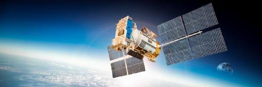
GHGSat UK is developing an advanced analytics platform that turns satellite data about greenhouse gases into practical information the government can use for increased accountability across emitting organisations and tailored mitigation strategies. The company’s constellation of satellites (pictured above) trace the source of greenhouse gases, particularly methane, directly to industrial facilities, providing accurate data within hours of an emission to help make informed decisions about reducing these harmful gases.
Guildford-based Earth-i is building a system that could create environmental information from satellite images by developing “novel” indicators for environmental land monitoring. It will provide analytics directly to the Rural Payments Agency, which manages farming subsidies and environmental schemes. The service will help monitor land changes and support sustainable land management.
HR Wallingford is leading a project that uses satellite information to help improve plant and animal diversity. Working with multiple partners, including Water Resources South East, it is developing ways to use Earth Observation data to track biodiversity changes over time. This will help landowners, developers and public bodies protect and enhance natural habitats.
The UK Space Agency is also due to launch a climate funding call, offering up to £300,000 in funding to help UK organisations develop climate services using Earth Observation satellite data. These small grants, of between £40,000 and £80,000 per project, are aimed at supporting early ideas that improve tools or services for tackling climate change, protecting nature, or helping society make more informed decisions for the planet.
The funding was announced at the European Space Agency’s Living Planet Symposium 2025, which aimed to present the latest scientific findings and applications based on satellite data, and to review the contribution that data and technologies have made and could further make in addressing environmental and societal challenges.
Read more about space-based communications
Eutelsat secures €1.35bn to expand satellite offer: Contemplated major capital increase designed to secure Eutelsat’s long-term strategic vision has been anchored by the French state and other reference shareholders.
European satellite operators take comms services to higher orbit: Kyivstar advances direct-to-cell services in Ukraine with Starlink integration and regulatory approval for testing, while Constellation Technologies and Operations announces the imminent launch of its first regenerative 5G mmWave payload.
2025 to be year of satellite commercialisation: Business intelligence arm of global mobile suppliers’ association rates this year as ‘ground zero for commercialisation’ of D2C communications depending on business plans of telcos.
Orange, Eutelsat expand LEO satellite partnership: Multi-year agreement enhances access to the benefits of low Earth orbit satellite communications to telco’s enterprise and government customers, and supports mobile backhaul to meet global demand.
Read more on Telecoms networks and broadband communications