naypong - Fotolia
UK investigates drone use for search and rescue
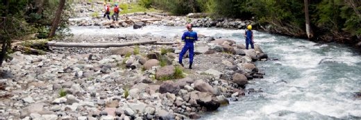
Maritime & Coastguard Agency will examine whether drones can be used to aid missions by visiting rescue sites

The UK government is assessing whether increased use of drones could enhance search-and-rescue operations by adding safety and operational efficiency.
The initiative, led by the Maritime & Coastguard Agency (MCA), will investigate whether the equipment can be used to aid missions by visiting rescue sites before air-, sea- or land-based recovery teams arrive.
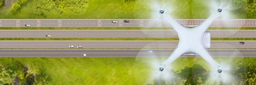
According to the MCA, another goal is to define whether regulations can be changed to make more use of development and implementation of beyond-visual-line-of-sight (BVLOS) drones, which can help teams to get a full picture of the situation and develop an appropriate response.
“Drone technology has enormous potential for our search-and-rescue teams, who save lives 24 hours a day, seven days a week,” said maritime minister Nusrat Ghani, who added that the technology can bring other benefits beyond search and rescue.
“This ground-breaking project will not only boost the capabilities of our already fantastic teams, but will also boost our ability to spot pollution hazards and protect our precious marine environment.”
The MCA’s civilian search-and-rescue helicopters responded to an average of seven missions a day in 2019, rescuing more than 1,600 people. In total, the agency coordinated more than 22,000 incidents and rescued over 7,000 individuals.
Elsewhere in government, the Ministry of Defence allocated a multimillion-pound budget to a project around the deployment of drones, along with autonomous vehicles, to the battlefield. New technologies will include mini-drones, in-vehicle systems with a remote-control capability that can be pushed ahead of manned vehicles in the battlefield, and autonomous vehicles that can perform tasks such as delivering supplies to troops in war zones.
Read more about drones
- Royal Navy readies autonomous technology push.
- Autonomous drones come with challenges and great potential.
- The business of autonomous vehicle data.
In the private sector, industries are being transformed through the use of drones, such as the insurance sector. After natural disasters or other major insurance events, companies in the sector are using drones and satellite data backed by recognition systems to collect instant assessments of potential damage claims for individual properties, making handling of insurance claims faster and more accurate.
And in real estate, drones and machine learning are being used to analyse images and generate additional data about properties. For example, information about roof conditions can be extracted from aerial photos taken by drones, giving customers a more detailed view of buildings for weighing mortgage and insurance applications.
Read more on IT for government and public sector
-
![]()
Maritime and Coastguard Agency to introduce digital assessments
By: Lis Evenstad
-
![]()
Surrey Search & Rescue taps Ericsson and UK Connect for critical connectivity
By: Joe O’Halloran
-
![]()
UK Coastguard deploys full-fibre network to enhance operations
By: Joe O’Halloran
-
![]()
What is a drone (UAV)?
By: Alexander Gillis