Openreach launches enhanced duct and pole mapping service
BT’s infrastructure arm, Openreach, has made digital maps showing its duct and pole network infrastructure available to allow other comms services providers to plan new fibre broadband networks

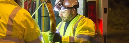
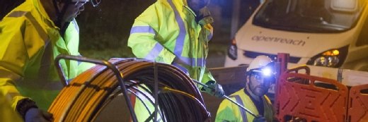
Openreach, the BT-owned national infrastructure provider, has launched an enhanced digital mapping tool showing intimate details of its network assets, as part of an Ofcom-mandated plan to make it easier for other communications service providers (CSPs) to plan, build and operate fibre-based broadband networks using Openreach’s network.
Opening up the Openreach duct and pole assets was a key demand made of BT by Ofcom in its 2016 review of the UK communications sector. The review stopped short of fully separating BT and Openreach – as many competitors had wanted – but imposed a number of conditions on the telco, and has retained the option to forcibly split the two if things do not change.
Duct and pole sharing is not a new concept, and has been tried in the UK before, but the idea had never gained much traction among BT’s rivals, who frequently accused BT of going out of its way to make the process as complicated as possible.
Openreach hopes that its new digitised network maps, which it developed voluntarily, will provide a comprehensive, instant and interactive view of its underground ducts, cable chambers and telephone poles.
Openreach CEO Clive Selley said: “As our infrastructure already exists, CSPs will be able to build and expand their fibre network in far quicker timescales than if building it from scratch. The mapping tool further enhances that process – giving CSPs exactly the same level of access to our network data as Openreach.
“Our ducts and poles have been open to these companies for several years, and Ofcom has been clear that the price to access them is in line with international comparisons, but they have not been used on a large scale to date. We hope that these new, simpler processes – which have been designed and developed in partnership with the industry – will encourage more companies to invest, particularly in parts of the UK that are not already served by high-speed networks.”
Openreach has been testing a number of procedural enhancements over the past six months, introducing new rules on faster surveying and building, allowing CSPs to inspect Openreach’s infrastructure themselves; giving CSPs the authority to carry out some work themselves without its permission, such as clearing blocked ducts; and installing new distribution joints inside its junction boxes.
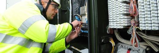
Enabling access to the web-based mapping service will further speed up this process, Openreach said, allowing CSPs to inspect static records and network diagrams to plan their network builds without having to constantly refer back through Openreach.
Read more about broadband
- How does the UK fund a full-fibre infrastructure if BT is unable and/or unwilling to pay the price?
- The government reaffirms previous commitments to further funding of rural broadband roll-out in its post-Brexit industrial strategy plan.
CSPs keen to use the service will be thoroughly vetted and verified before gaining access to what remains in many cases extremely sensitive data, said James Lilley, Openreach general manager of service and infrastructure product.
“Network records are very confidential,” he told Computer Weekly. “We only want it used for the correct purposes, as it can contain secure information on government buildings or nuclear power stations, for example.”
Once vetted, CSPs will receive a login to use within their teams, subject to a fair use policy. The maps themselves show a highly detailed picture of what exists in a given area – generally searchable by postcode – viewable at multiple levels. CSPs will then be able to “reserve” the infrastructure they want to use, said Lilley.
Subject to planned enhancements, they will eventually also be able to see how much physical capacity remains in a duct, and which parts of the network have been reserved for building work by other CSPs. Users will also eventually be able to download the data and incorporate it into their own geographic information systems. According to Openreach, this will significantly shorten the network design process.
“Theoretically, a CSP could access the data on Monday, reserve the ducts the same day, and by the following week they could be out building their network,” said Lilley. “In reality, of course, it depends on other issues, such as planning permission and wayleaves.”
Lilley said he hoped the service would “put the onus on CSPs” to do more work to plan their networks without relying so much on Openreach. .......................................................................................................